 |
|
|
| Lea Bridge Conservation Area Appraisal |
| In May 2005 Hackney Council produced a document to justify the declaration of a conservation area in Lea Marsh titled "Lea Bridge Conservation Area Appraisal". It contained some fantastic images. |
| Lea Bridge Conservation Area Appraisal May 2005 |
| 1 INTRODUCTION |
|
1.1 The Format of the Lea Bridge Conservation Area Appraisal
This document is an "appraisal" document as defined by English Heritage in their guidance document "Conservation Area Appraisals". The purpose of the document is, to quote from the English Heritage document, to ensure that "the special interest justifying designation is clearly defined and analysed in a written appraisal of its character and appearance". This provides "a sound basis, defensible on appeal, for development plan policies and development control decisions" and also forms the basis for further work on design guidance and enhancement proposals. This appraisal describes and analyses the particular character of the Lea Bridge Conservation Area. This includes more obvious aspects such as its open spaces, buildings, and architectural details, as well as an attempt to portray the unique qualities which make the area "special". These include less tangible characteristics such as noise or smell, and local features which are unique to the area. The document is structured as follows. This introduction is followed by an outline of the legislative and policy context (both national and local), for the Conservation Area. Then there is a description of the historical development of the Conservation Area followed by a description of the Conservation Area and its surroundings. A number of Appendices contain supplementary information including schedules of the streets within the Conservation Area and listed buildings. Appendix C provides a bibliography. A map is included at Appendix D. Appendix E notes sources of further information. |
| 1.2 Acknowledgements |
| This document has been drawn up with the assistance of material prepared by the
Clapton Conservation Area Advisory Committee.
For details of how to become involved with your local conservation area advisory committee please contact the Hackney Society, contact details of which are given in Appendix E. |
| 2 PLANNING CONTEXT
|
|
2.1 National policies
Individual buildings "of special architectural or historic interest" have enjoyed a means of statutory protection since the 1950s, but the concept of protecting areas of special merit, rather than buildings, was first brought under legislative control with the passing of the Civic Amenities Act in 1967. A crucial difference between the two is that listed buildings are assessed against national criteria, with lists being drawn up by the government with advice from English Heritage. Conservation Areas, by contrast, are designated by local authorities on more local criteria, and they are therefore very varied - small rural hamlets, mining villages, or an industrial city centre. However, general guidance on the designation of Conservation Areas is included in Planning Policy Guidance Note 15 (PPG15), which sets out the government's policies on the historic built environment in general. By 2005, the London Borough of Hackney had designated 22 conservation areas. |
|
2.2 Local Policies
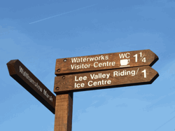
Legislation and guidance has emphasised the importance of including firm Conservation Area policies in the Unitary Development Plan (UDP), which must in turn be based on a clear definition of what constitutes that "special architectural or historic interest" which warranted designation in the first place. The Environmental Quality chapter of Hackney's Unitary Development Plan of 1995 contains Policies EQ11 to 15, concerning the designation and control of Conservation Areas. The justification to Policy EQ15 explains that the existing historic areas within the Borough fall roughly in four groups, and as staff resources permit, the Council will consider the designation of further Conservation Areas, and the amendment of boundaries to existing Conservation Areas. These groups are: ? Town centres and village cores: with buildings of varying age and type that will also include Georgian and Victorian ribbon development; for example, Dalston Lane and Broadway Market. ? Residential areas: especially areas characterised by villas - a particularly well developed Hackney building type. ? Open spaces and their settings: for example, London Fields and Stoke Newington Common. ? Industrial Heritage: for example, the Regent's Canal and Waterworks Lane, Lea Bridge. |
|
3 THE HISTORICAL DEVELOPMENT OF THE AREA
|
|
3.1 Historical development
The River Lea, along with the River Fleet, is second only to the Thames, as the oldest of London's waterways. The Danes sailed up the River Lea in the late C9th to sack Hertford, and since the early C13th the River has been used regularly for the transportation of goods into and out of the capital. Navigation along the River Lea has been continually improved throughout its history; many of the improvements being sanctioned by Acts of Parliament and funded through tolls. Improvements to the River took the form of dredging, removing obstacles from the waterway, and cutting new channels and locks. Flood relief channels were also constructed. Warehouses and wharfs were built on the banks of the River, although in many areas it retained its open rural character. Improvements continued until as recently as the 1930s, and even as recently as the 1960s the River was used regularly for the transportation of goods, such as timber and coal. There are few remaining timber-yards on the banks of the River, and any that remain are now supplied by road transport. |
 |
| Lea Bridge Mill.c1850. Watercolour by C.Bigot. |
|
The River Lea has also been used as a source of power by a number of mills along its
banks. In certain areas this led to a reduction in the navigable width of the River,
causing friction between the millers and the bargemen. Industries and communities
along the River also used it as a source of water, again leading to friction with the
bargemen as water levels were often reduced.
|
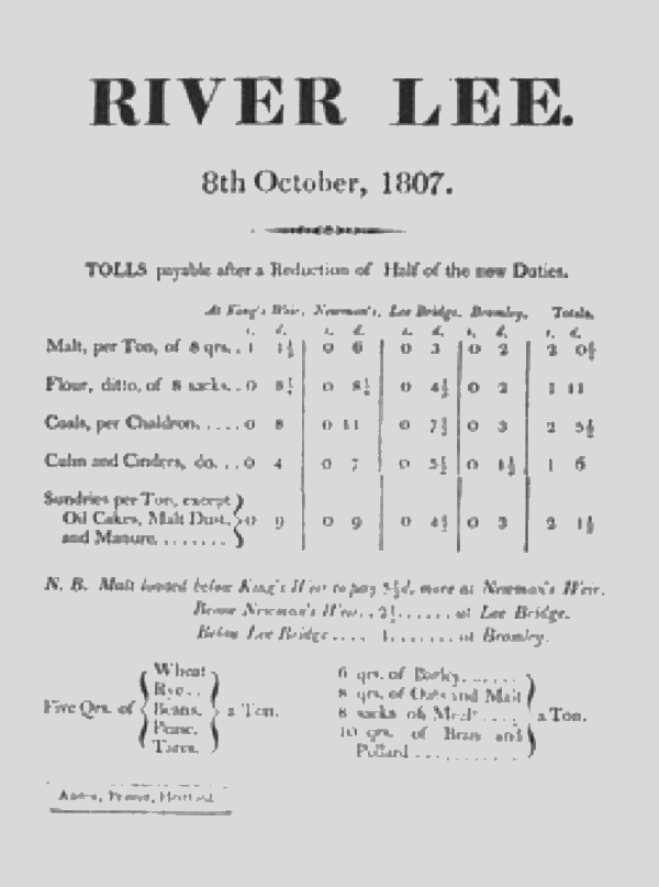 |
| Toll charges on the River Lea, 1807. |
| Along with wharfs and waterworks a number of service industries, such as boatyards, sprang up along the banks of the River Lea. The River was also used for recreational purposes, with rowing and boating clubs being based along its length. Regattas were organised during the summer months, and the riverside became a popular location for public houses and inns: serving both those who worked on the River and those using it for leisure pursuits. Housing was also built, for those working on and alongside the River, although until recently much of it was subject to flooding when the River Lea burst its banks. |
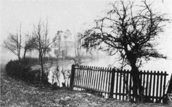 |
| Horse Shoe Point on the River Lea, Showing the rural character of the Lea Valley, 1888. |
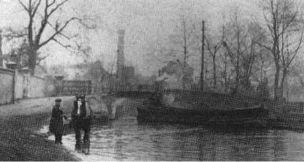 |
| Barges on the Hackney Cut, just south of the Prince of Wales Public House, c1900. |
 |
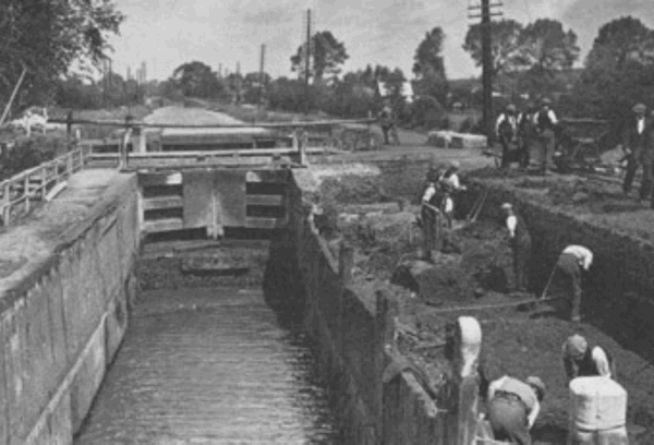 |
| Works to the River Lea Navigation, c1920s. |
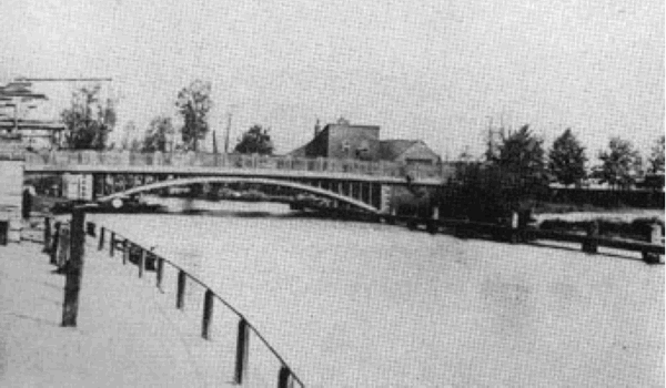
| The second Lea Bridge, built in 1820, seen from the north, c1890. To the left is the timber yard of Essex Wharf and above the bridge is the original Prince of Wales Hotel. |
| 3.2 Lea Bridge and its Environs
The first bridge at Lea Bridge was constructed of timber in 1757, replacing Jeremy's Ferry. The second Lea Bridge was constructed in 1820, but was itself replaced in 1892. By the 1830s Paradise Dock (later known as Lea Bridge Dock) had been cut and a more coherent cluster of development had been constructed around along its sides. Throughout the C19th this was supplemented by further residential, commercial, and industrial development. The East London Waterworks (Lea Bridge Station) were also constructed during this period, to the east of the River Lea. The C19th also shows residential development springing up around the Millfields Recreation Grounds, although as this is common land (now designated as Metropolitan Open Land) the buildings around Lea Bridge remained as a distinct group. An auction catalogue and plan (see figure 13) from 1902 lists a variety of lots for sale at Lea Bridge: a glass factory, boat builders (with dressing rooms and club rooms), a carbonic acid gas factory, an India rubber works, and cottages, as well as the Ship Aground Beer House. The area around Lea Bridge reflects the many uses of the River Lea. In 1935 a furniture works was constructed to the rear of the carbonic acid works to Otley Terrace. Drawings from this period indicate that the Lea Bridge Dock was still in use, although by the 1960s it had been filled in. |
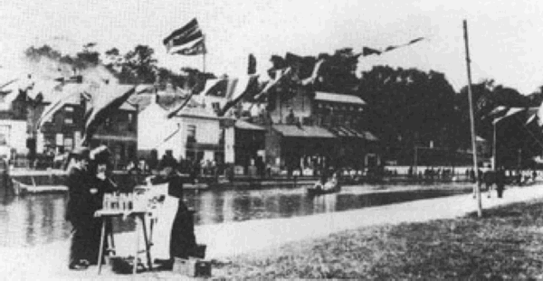 |
| Leisure activities, such as rowing, on the River Lea, 1890. |
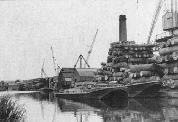 |
| Transport of goods continued on the River Lea until relatively recently. This view was taken in 1966 (Photo: Frank Chambers) |
| 3.3 Historical Maps |
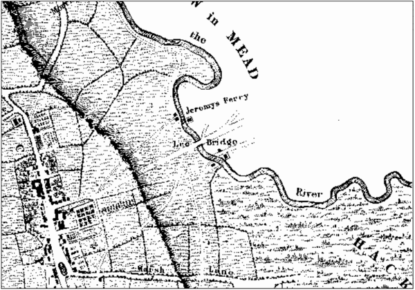 |
| Map of 1745 |
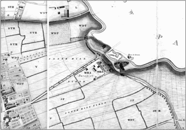 |
| Map of 1831 |
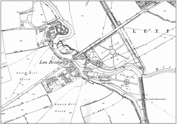 |
| OS Map of 1869 |
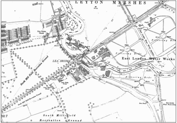 |
| OS Map of 1894 |
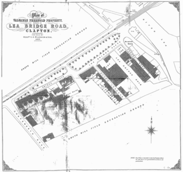 |
| Plan of plots auctioned in 1902. |
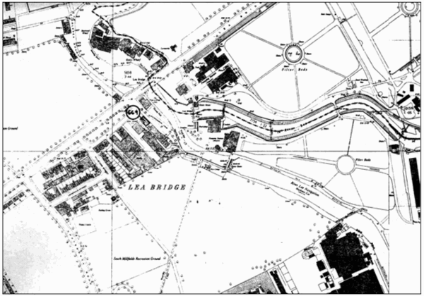 |
| OS Map of 1966 |
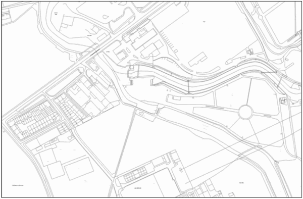 |
| Contemporary OS map
|
|
4 THE CONSERVATION AREA AND ITS SURROUNDINGS
4.1 The Surrounding Area The Lea Bridge Conservation Area lies within the London Borough of Hackney, which itself is some five miles to the north of the River Thames. The eastern boundary of the Borough is formed by the River Lea, which meanders in a south-easterly direction from Tottenham down to the Thames at Canning Town. To the west lies Finsbury Park and Highbury, and to the south, the City of London. The area immediately surrounding the Lea Bridge Conservation Area retains its open, green landscape character; with the Millfields Recreation Grounds (to the north, south and west) and the Lea Valley to the east. This open landscape character is important to the setting of the Conservation Area and the River Lea itself. |
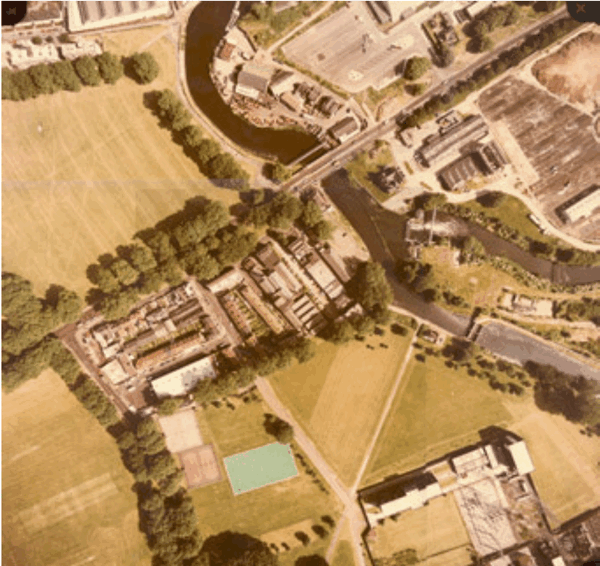 |
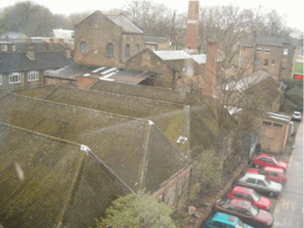
| Figure 16 Aerial view of the area, showing the large expanses of green space surrounding the Lea Bridge Conservation Area |
| 4.2 General Description of the Conservation Area
The Lea Bridge Conservation Area includes a core of buildings, mainly from the C19th, reflecting the historic uses of the River Lea. This includes former industrial buildings, and the line of the former Lea Bridge Dock, still evident in the open spaces and building plots of the remaining development. The Conservation Area also includes two well detailed historic public houses, reflecting the leisure activities still evident along the banks of the River Lea. These buildings, along with the open spaces and mature trees, form a coherent and distinctive townscape, surrounded by an open landscape and riverside setting. This open character is important in views into and out of the Conservation Area, as well as in views along the banks of the River Lea. Adjacent to the Conservation Area, to the east, are the remnants of a former waterworks, which are of interest in their own right. |
 |
| Mature trees and open aspect along the banks of the River Lea |
| 4.3 Streetscape
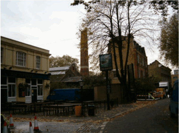
The buildings within the Lea Bridge Conservation Area form a distinctive and coherent piece of townscape. The industrial nature of many of the buildings is softened by the surrounding landscape, with its open green spaces and mature trees. This is especially evident in views into and out of the Conservation Area. The buildings to Lea Bridge Road form a coherent frontage and are largely set back from this busy arterial route. The buildings fronting Lea Bridge Road are seen behind groups of mature trees. This is also true of the buildings within the Conservation Area when viewed from the River Lea. Within and immediately adjacent to the Conservation Area are streets of a much smaller scale to that of Lea Bridge Road, containing small-scale domestic terraces and low industrial buildings. The Conservation Area also contains a number of streets and open spaces which retain their original cobbled surfaces as well as historic boundary markers, along with other street furniture, such as the post box to the end of Hillstowe Street; it is important that these are retained in the future. Also of significance is the line of the former Lea Bridge / Paradise Dock. This is still evident in the open space between the industrial buildings, although it is not known whether the canal lining remains below the surface. This open space and the associated building lines which reflect the line of the former Dock are an important feature of the Lea Bridge Conservation Area. |
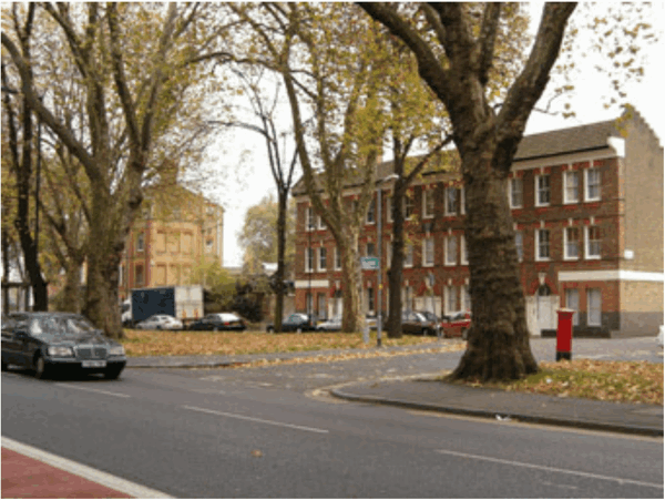 |
| Historic buildings forming a coherent frontage to Lea Bridge Road. |
| 4.4 Views, focal points and focal buildings
The Princecess of Wales Public House is a prominent building within the Conservation Area, both in views along Lea Bridge Road (from the east and west) and along the River Lea. Both the Lea Bridge Road frontage and the river banks contain important groups of trees which are prominent in views into and out of the Conservation Area. The chimneys and distinctive gable to the former carbonic acid gas works are important features within views around the Conservation Area. The low scale of development within the Conservation Area is especially evident in views along the small streets and across the open landscape areas surrounding the Lea Bridge Conservation Area. |
 |
| The line of the former Lea Bridge / Paradise Dock, still reflected in the open spaces of the Conservation Area. |
| 4.5 Landscape and trees
The most significant groups of trees lie along the Lea Bridge Road frontage and the river banks. The open, green spaces which form the setting of the Conservation Area are important in views into and out of it, as are the grassed verges fronting Lea Bridge Road. Within the Conservation Area, open spaces are characterised by more hard landscapes of a more industrial character. |
 |
| Historic waterworks and related features to the River Lea |
| 4.6 Activities and Uses
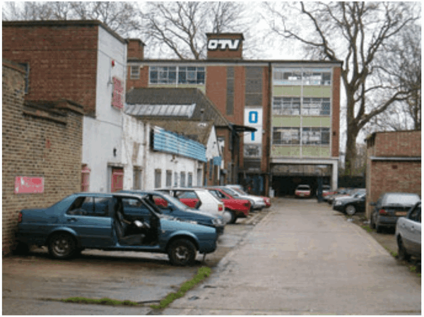
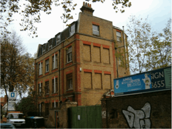
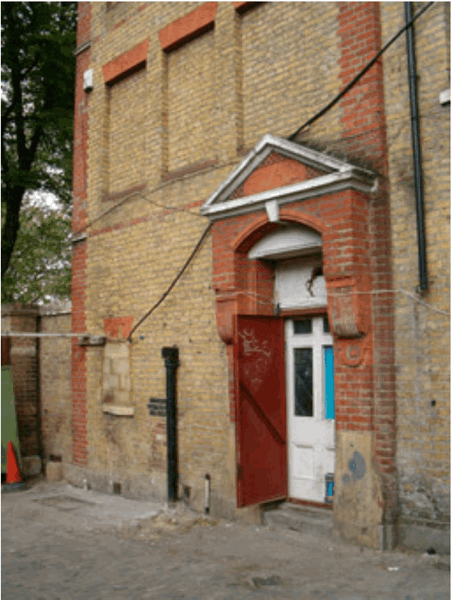
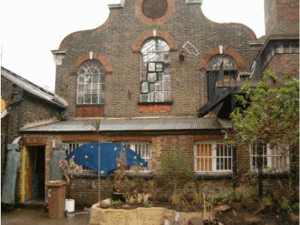
The activities and uses within the Conservation Area reflect the traditional riverside uses evident along the River Lea: industrial buildings, public houses, and houses. The area retains an important mixture of uses. 5 THE BUILDINGS OF THE LEA BRIDGE CONSERVATION AREA 5.1 Introduction The Lea Bridge Conservation Area contains an interesting group of buildings dating mainly from the 19th century. They reflect the historic uses of the banks of the Lea River: former industrial buildings clustered around the infilled Lea Bridge Dock, a number of good quality public houses, and houses. 5.2 Listed buildings There is one listed building in the conservation area: a former school building to Waterworks Lane. Unfortunately, this building is identified by English Heritage on their Buildings at Risk Register. The building is currently empty and in need of conservation. The list description for the building is as follows: "1 WATERWORKS LANE E5 5013 (West Side) ------------------ Premises of Testi & Sons, Millwrights TQ 3586 14/669 II |
|
2.
Mid C19 L-shaped building of coursed rubble, with freestone dressings, in Tudor style.
Probably originally a school but now in industrial use. 1-storey north section
(schoolroom?) and shorter 2-storey south part (house?). Large Tudor-arched north
window, the others square-headed all with hoodmoulds. High pitched tiled roofs:
house section has a row of conjoined octagonal chimneys on west side and a bellcote
on east. Gabled west porch with Tudor-arched entrance. An interesting survival in a
depopulated area."
|
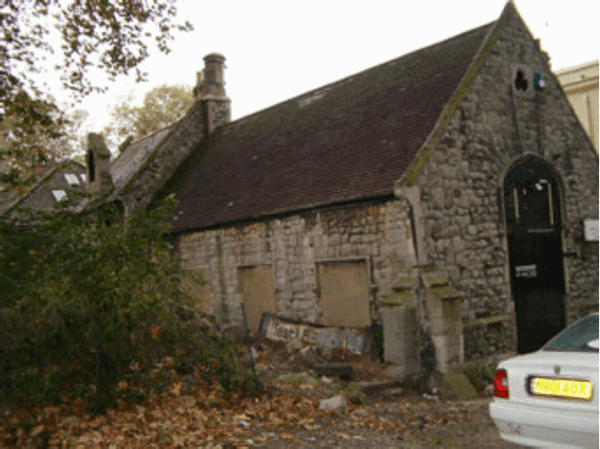 |
| The listed former school building, Waterworks Lane (grade II) |
| 5.3 Buildings of Townscape Merit
A number of unlisted buildings in the Conservation Area have been identified as "Buildings of Townscape Merit". These are well detailed examples of mainly mid-late |
|
19th century houses or commercial premises which retain their original detailing. As
such, they make a positive contribution to the character and appearance of the
Conservation Area, and any proposals to alter or demolish such buildings will be
strongly resisted by the Council (see Policy EQ13 of the UDP of 1995). Together,
these buildings provide the cohesive and interesting historic townscape which is
necessary to justify designation as a Conservation Area.
The Princess of Wales Public House, Lea Bridge Road The Princess of Wales Public House is a prominent building in views along Lea Bridge Road and along the River Lea. The current building dates from 1920 when the Prince of Wales Public House was rebuilt. It is well detailed building which retains many of its original features, and remains in use a pub. |
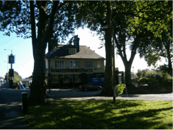 |
| The Princess of Wales Public House, Lea Bridge Road |
 |
| The Ship Aground Public House (to the left, with the former carbonic acid gas works to the centre and right) |
| The Ship Aground Public House, 144 Lea Bridge Road
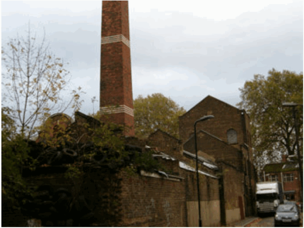
Like the adjacent Prince of Wales Public House, The Ship Aground is a well detailed late C19th public house. It is stucco fronted with its roof hidden behind a parapet. It too retains many of its original features, and remains in use a pub, although its position, being set back from the main road, is less prominent than that of the Prince of Wales. Former Carbonic Acid Gas Works, 142 Lea Bridge Road This complex of industrial buildings was formerly used as a carbonic acid gas works, and subsequently used as a furniture works. Given its location on the former Lea Bridge Dock and the presence of glass bottle works on adjacent sites, it is likely that the works was used to create carbonated drinks. Dr Joseph Priestley, the creator of the first drinkable manmade glass of carbonated water in 1767, was resident in Hackney from 1792-1794, although a link with this building has not been proved. A plaque marks the site of Dr Priestley's residence, now occupied by 113 Lower Clapton Road. The former carbonic acid gas works comprises of a front office block and a rear range of works buildings, along with two, prominent well detailed chimneys. |
 |
| Former Carbonic Acid Gas Works (view along Otley Terrace) |
 |
| Former Carbonic Acid Gas Works, front block |
| The front block appears to have been constructed as offices for the complex. It is a
well-detailed brick building of three storeys plus a mansard roof. It has a main
entrance to Lea Bridge Road and an ornate brick side entrance leading into the open
yard. The yard between the office block and the range of rear works buildings has a
cobbled surface and contains significant traces of inset iron rails for trolleys, used to
move goods around the works, and presumably to load and unload goods from the
adjacent Lea Bridge Dock.
The rear block is an important survival of the industrial heritage of the River Lea. It has an ornate gable facing Lea Bridge Road, with terra cotta detailing, and a handsome chimney. To the rear, running along Otley Terrace, the complex has a taller element, which presumably housed machinery or tanks for liquid. The whole rear complex has well detailed, original wrought and cast iron windows. |
| To the rear of the C19th complex is a group of lower industrial buildings which were constructed in 1935, for use as a furniture works. |
 |
| Former Carbonic Acid Gas Works, front block side entrance. Also shown are the cobbles to the yard. |
 |
| Former Carbonic Acid Gas Works, from rear |
 |
| Former Carbonic Acid Gas Works, gable detail with chimney to right |
| 132-140 Lea Bridge Road This row of late C19th houses is similar in style to the block to the front of former carbonic acid gas works to the east, with which it forms a coherent group. It is a well detailed, unified, brick terrace of three storeys which retains its original sashes and many of its original features. |
 |
| 132-140 Lea Bridge Road |
| 6 CONCLUSIONS
6.1 Proposed Boundary of the Conservation Area The boundary of the Lea Bridge Conservation Area has been drawn to include the listed building and buildings of townscape merit, as well as the site of the former Lea Bridge Dock. Consideration should be given in the future to the inclusion of the historic waterworks and sluices to the east of the current boundary and the workers' cottages to the west. 6.2 Conservation The Lea Bridge Conservation Area includes a core of buildings, mainly from the C19th, reflecting the historic uses of the River Lea. The historic buildings within the Conservation Area, and their settings, should be preserved, as should the open nature of the green spaces around the Conservation Area itself. The open footprint of the former Lea Bridge Dock should also be preserved. |
APPENDIX A |
|
SCHEDULE OF PROPERTIES IN THE CONSERVATION AREA Lea Bridge Road: Nos. 132-140 No. 142, former carbonic acid gas works, including the complex to the west of Otley Terrace / Lea Bridge Dock No. 144, The Ship Aground Public House No. 146, The Princess of Wales Public House (No. 146a, Former School Building / Testi and Sons) Otley Terrace: No. 13 Waterworks Lane: Former School Building / Testi and Sons (also known as no. 146a Lea Bridge Road) Former industrial buildings to rear of Testi & Sons Building and no. 144 Lea Bridge Road |
APPENDIX B |
|
SCHEDULE OF STATUTORILY LISTED BUILDINGS Statutorily listed buildings (grade II): Waterworks Lane: Premises of Testi & Sons, Millwrights |
APPENDIX C |
|
BIBLIOGRAPHY The London Borough of Hackney David Mander in Old Photographs (Alan Sutton Publishing Ltd, 1989) London's Waterways Martin Denney (Batsford) Victoria County History: Middlesex Out of print- copy available at Hackney Archives |
APPENDIX D |
|
MAP OF THE LEA BRIDGE CONSERVATION AREA Map of the Conservation Area showing: Boundary of the Lea Bridge Conservation Area Listed buildings Buildings of Townscape Merit Focal buildings Important open spaces & trees |
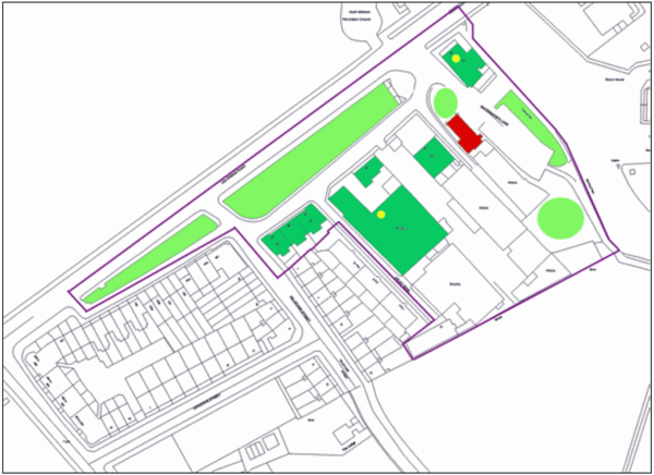 |
| Map of the Lea Bridge Conservation Area. |
APPENDIX E |
| FURTHER INFORMATION
The Conservation and Design Team Planning and Transportation London Borough of Hackney Dorothy Hodgkin House 12 Reading Lane London E8 1HJ Tel: 020 8356 8033 / 8071 / 8217 Fax: 020 8356 8087 Website: www.hackney.gov.uk/planning |
| English Heritage 23 Savile Row London W1S 2ET General inquiries: 020 7973 3000 Customer Services: 020 7973 4916 For further information relating to listed buildings and conservation areas |
| The Victorian Society 1 Priory Gardens Bedford Park London W4 1TT Tel: 020 8994 1019 For the "Care for Victorian Houses" leaflet, etc. |
| The Society for the Protection of Ancient Buildings (SPAB) 6 Fitzroy Square London W1P 6DY Tel: 020 7377 1644 For an excellent range of technical advice leaflets |
| The Hackney Society Unit B12 3 Bradbury Street London N16 8JN Tel: 020 7254 0212 Hackney's local amenity society and umbrella organisation for conservation area advisory committees |
APPENDIX F |
| COPY OF COUNCIL'S CABINET REPORT ADOPTING THE CONSERVATION
AREA BOUNDARY AND APPRAISAL
(To be added following formal adoption of the Appraisal & final recommendations) |