| Main index | Brind press cuttings | Sources index | More about Highworth enclosure |
 |
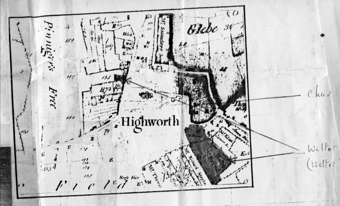
| The above map comes from a document produced by Edward Elwell, solicitor, Highworth, Wilts, and is dated Oct 1st, 1934, though evidently that is the date he made the copy not the date of the original map |
| The 1934 document says: "The above is an enlargement of the area surrounding St Michael's Church in the centre of Highworth. Land owned by Walter Brind is shewn coloured pink." |
| It also features a map of Highworth, picking out the church. This is now so badly damaged that it is pointless to copy it. The text besides it says: "This is a photograph (taken to my instructions) of a Map in the possession of the Solicitors to the Descendants of Mr William Hussey, which map I am satisfied was a contemporary but unsigned copy of the Map directed to be made by the Commissioners for the Inclosures of Highworth in 1779. The original of which Map has been missing for over 50 years. My reasons in support of this are that it gives all the details of the various properties as mentioned on the Inclosure Award, with the names of the various owners at that time and particularly shows the land awarded to the Vicar in lieu of Tithes in accordance with the Award. The Map was lent to me for the purpose of making a copy after which it was arranged that the original should be deposited at the Devizes Museum.
Edward Elwell, Solicitor, Highworth, Wilts, Oct 1st, 1934," |
| "The above is displayed at the Highworth office of Elwell & Son, solicitors and is re--produced here by reason of its documentary interest to the Brind family." |
| The map is very frustrating for a non-local since it is very difficult to pin down anything. The Google Earth picture below shows St Michael's Church (it's in the centre towards the left at the end of St Michael's Avenue). It is not easy to find any information about a horse fair in Highworth, mentioned in an inscription at the centre of the map towards the bottom. Pinnigree's Free (whatever that might be) is equally illusive. This is a link to another, clearer map of land holdings in Highworth at the time. |