 |
|
| Land ownership | 
(6/Sept/2014)
|
| Two maps were revealed by LVRPA at a site management workshop
on Saturday September 6, 2014. This seemingly childish effort, which appears to have been created by crayon, is not an attempt to produce a piece of modern art, but is LVRPA's view about land ownership of the marshes. The motive for showing the map may have been something to do with the fact the Network Rail recently closed down the Triangle. LVRPA representatives maintained that the authority was about to lease this land. Of course, leasing a small parcel of SSSI should be well within the means of LVRPA. Agricultural land, which is all this area could be used for as long as it retains the gold standard planning control of being regarded as an SSSI, is only worth a few hundred pounds an hectare. Leasing it should be possible for small change, if only because ownership is a financial liability rather than the holding of a commercial asset. Click the map to see the key
. |
| On the other hand LVRPA also linked the leasing to what was described as a land rationalisation strategy. In the context that LVRPA is attempting to split itself into two, one commercial
the other green space holding, such a phrase is chilling. The park side has little need to establish clear ownership of the land it occupies since it is covered by the 1966 Act
and its activities have no commercial value. In addition, its assets (especially those that are part of the SSSI) have little tangible value. So why bother spending a lot of extremely expensive management time on a futile exercise? If the managers have so little to do they could be deployed picking up litter.
|
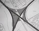
| The second map is very interesting and potentially far more positive. It shows the areas of land LVRPA is negotiating to lease from Network Rail. It appears to show the fenced off area between the railway line and the Sustrans
in Coppermill Field. It also shows the large area between Sustrans and the Flood Relief Channel
. This is an interesting area in itself but it is also possible to get access to it using the Low Hall Sports Ground
, particularly via the road running down the back of the industrial buildings. Access,, in this context, is a bit of a strange term since you still need to cross the railway and the Flood Relief Channel. But it would be a lot more practical to build the huge ramp required to give wheelchair access to the marshes here, than it would at Argall Avenue.
| 
(6/Sept/2014)
|
| Gaining access to these 'new' areas of land would be of major benefit to the community, especially people living in Waltham Forest. |
|