 |
|
|
|
|
| 3) Lea Bridge Road |
| 4) Sandy Lane |
| 5) Black Path |
| 6) Aqueduct Path (Sustrans Route) |
| 7) Bridle Way |
| 8) New east west path across riding centre |
| 9) New south north path to east of Riding Centre |
| Complete Map |
|
|
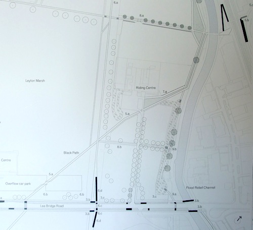
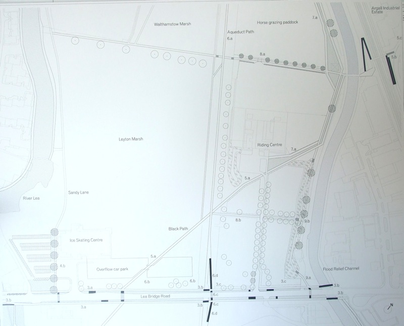
 | 3) Lea Bridge Road a) New foot and cycle paths set away consistently from road edge, separate path from street with drainage swale. Clear road edges of shrubs to allow views onto the landscape. A new pedestrian crossing. See cross section diagram. |
COMMENT: The crossing is a good idea. Lea Bridge Road is very difficult to cross. |
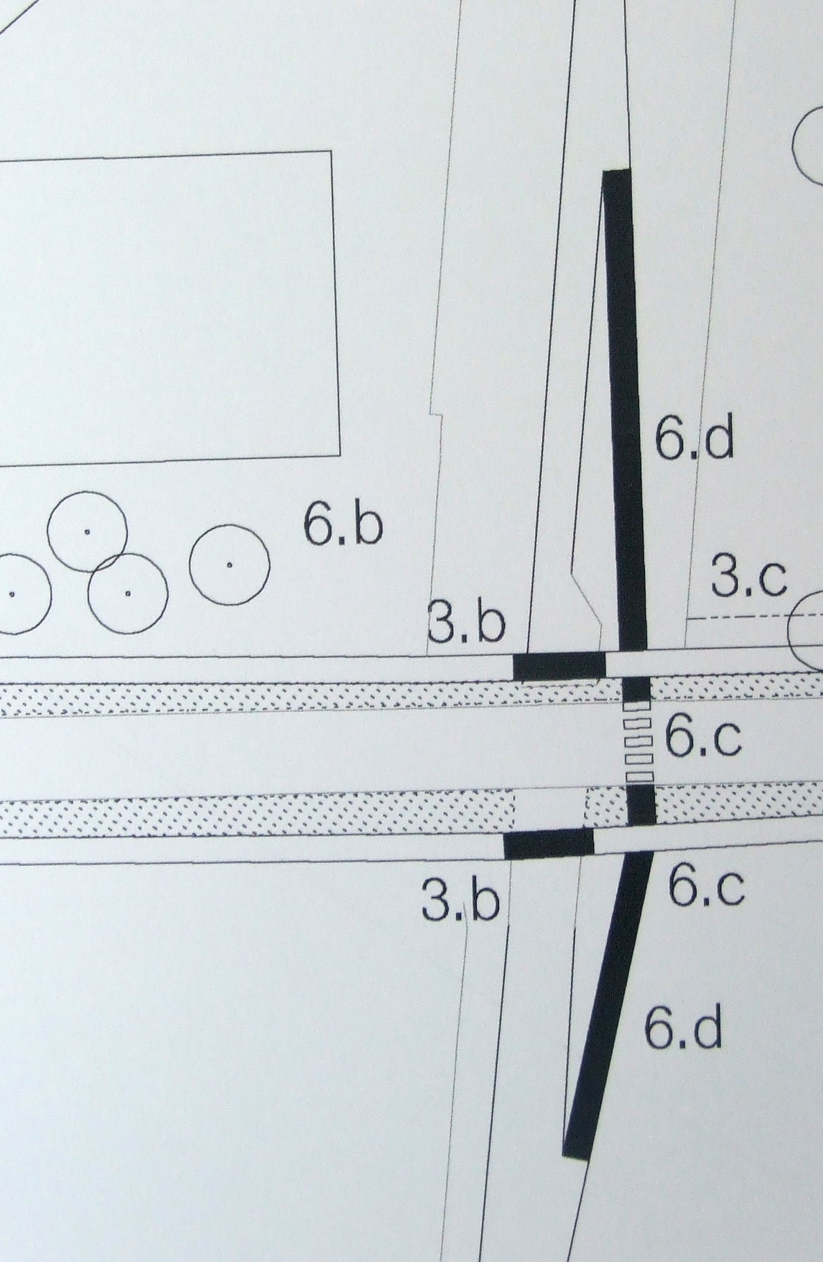 | b) New secondary bridges supporting separate foot and cycle paths. Bridges required at River Lea Aqueduct Path (Sustrans Route) and Flood Relief Channel | 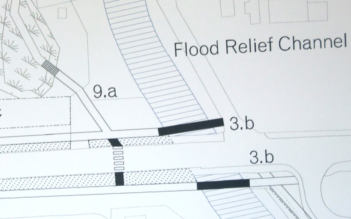 |
COMMENT: This is a brilliant idea. LVRPA is creating a dedicated footpath/ cycle path separate from the road, all the way from the flood relief channel to the Lea Bridge. Magic. See cross section diagram. |
|
c) Extend horse paddocks to new foot and cycle path to raise awareness of activities on Lea Bridge Road. |
COMMENT: The basic idea is a creeping process of privatisation, with the riding centre stamping its hooves ever more firmly on the area. This is not in the long term interests of the horse community since this facility only exists by virtue of LVRPA's subisdy, see economics. If the centre ever does escape from LVRPA's control whoever takes it over will build flats there. |
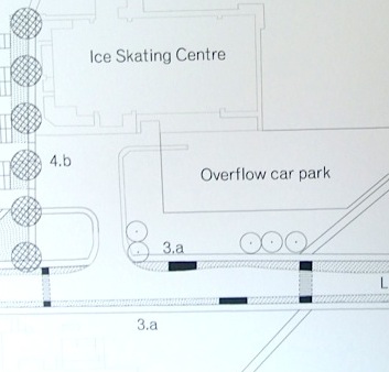
| 4) Sandy Lane
b) Improved open entrance to Sandy Lane adjacent to the Ice Centre Extension of Sandy Lane gravel track to Lea Bridge Road with swale border and tree planting. |
COMMENT: This is completely pointless. The problem with the ice rink is that it is noisy and smelly. Put a row of trees in front of it and it is still noisy and smelly. At the user group meeting it was suggested that the car park might be extended in exchange for this tree lined avenue. In January 2010, when a video was being made several production vehicles occupied much of the car park and there was still no problem. Car access to Lea Marshes is difficult because Lea Bridge Road is often jammed, not because the car park is full! |
| 5) Black Path
a) Reform Black Path across Riding Centre paddocks and Ice Centre overflow car park- new paddock boundaries and revised car park footprint. Use timber posts and supplementary structure planting to define walkway. See design of path running through paddock.
|  |
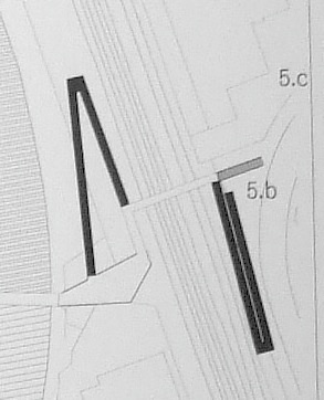 | b)Redesign access to existing bridge and improve accesiblity to bridge by new ramp access either side. |
COMMENT: These are enormous ramps. But even so they will not be sufficient to allow comfortable wheelchair access. Will LBWF really want such huge, unsightly ramps on the Argall Avenue side. See Argall Avenue location for ramps. |
| c) Consistent landscape and public realm design through Argall Avenue industrial estate. |
COMMENT: "A foolish consistency is the hobgoblin of little minds, adored by little statesmen and philosophers and divines." Ralph Waldo Emerson. 1803-1882 |
| 6) Aqueduct Path (Sustrans Route) |
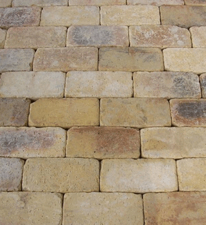 | a) Replace in long term by path in clay pavers and straighten. |
COMMENT: Clay pavers would be an improvement but a Sandy Lane (like the Sandy Lane) would be the best option. Right now the sustrans route seems pretty straight. It would be interesting to see this proposal on a map. |
| b) Clear shrubbery |
COMMENT: What makes Lea Marsh special is that it is as close to a wilderness as you can get in London. Aren't there better ways to spend the budget than tidying every last little area up? |
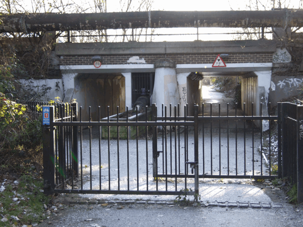 | c) Straighten access and replace gate, option would be to use pollards instead of gate. |
COMMENT: The path looks pretty straight right now. In fact, the least straight thing about it is the proposed new ramps (6d). What can this mean? Whatever it means, pollards would certainly be better than gates but how would they be planted in the tarmac? Probably in pots! |
 | d) New and straight access ramps to Lea Bridge Road. |
COMMENT: Good idea. It will certainly improve wheelchair and pram access. |
| 7) Bridle Way
a) New bridle way from front of Riding Centre leading north. Realign paddock boundary, separated from Black Path by meadow strip. See cross section diagram. |
COMMENT: Good idea. Walkers are being given more space and the look of this previously rather spartan path will improve dramatically. Some will miss the fact that you will not be able to feed the horses anymore. It is also a missed opportunity. There is a substantial chunk of land between the flood relief channel and the railway. A horse path there would be a real improvement. |  |
 8) New east west path across riding centre a)Form new grass path between exercise and grazing paddocks to north of Riding Centre. New hedgerow to south of path, structure planting to north of path- pollard willows on parish boundary. See detailed drawing. |
COMMENT: This seems to be a good idea and will genuinely improve access. The trees are supposed to be hybrid Black Polars, not willows, but they have clearly been pollarded already. |
 |
b)East west path to front of Riding Centre. Narrow down existing path and extend paddocks to path. |
COMMENT: This is quite a narrow path, considering it has been used by heavy vehicles getting access to the marshes. The pursuit of every square inch of land as fenced in horse land is quite disturbing. |
 | 9) New south north path to east of Riding Centre
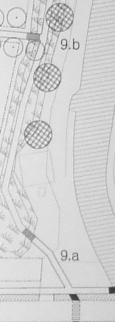
a) Create link to existing path. b) Fill in existing earth mound to enable path running on top of mound. New access steps from existing east west path. |
COMMENT: Improving this path is not a bad idea. It would be even better to improve the access to this path so that wheelchairs could get in and out, easily. |
 |